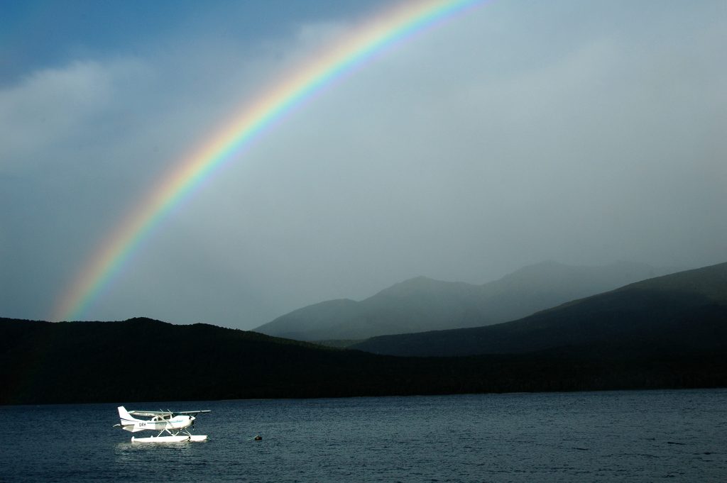
Getting to and from the Smoky Mountains can be pricey if you’re on your own, but well worth it. I, however, was not on my own, and was able to split the $75 shuttle ride to the southern end of the park with my friend Dawn. We arrived in the evening at Fontana Dam, where the Appalachian Trail enters the Great Smoky Mountains National Park.
My pack weighed just over fifty pounds. And I know this only because fifty pounds is the max allowed by the bus, which I took from Asheville, NC to Waynesville, NC where I picked up the shuttle. To lighten my pack, I pulled out the heaviest thing, my three liters of water (nearly nine pounds!) and carried it on with me.
That first night after walking all of 200 yards from the shuttle drop off to the shelter, I quickly figured my first meal would be my heaviest: pizza. Eating the weighty pizza the first night must have done some good, but the pack’s weight loss wasn’t really fully appreciated on our first true day on the trail. My pack still weighed fifty- some pounds and my friend, Dawn, and I had some serious ups ahead of us. We left Fontana Dam Shelter, hiked along the road across Fontana Dam until we found that all too familiar white blaze of the Appalachian Trail and started heading up into the woods.
The fall colors were in full swing. We found out on our ride in to the hills yesterday that the particularly wet summer this year actually stifled the vivid potential of the deciduous trees around us. It was still very beautiful, and we slowly ascended through a variety of fall foliage displays on our 2,500-foot gain for the day. At the lower elevations, the leaves were still thick on the trees, pushing bright yellow mixed with a few splotches of orange and red into our sight. Slowly, as we got closer to various ridge crests, the leaves would thin from the trees as they were stripped off by the sometimes puissant winds prone to blow over these hills.
Our first major stop for a snack and a pack drop was in a nice sunny spot just below Sassafras Gap at 4,000 feet. The air temperature was in the low fifties, and an occasional breeze would really make itself known as it blew across any wet spots on my shirt. The sun felt great and we happened to be in a nice little wind-shadow. I took my pack off and faced the shoulder straps and back support to the sun to help it dry.
The bulk of our climb was done, but we still had the undulating ridgeline to follow to our first camp, Russell Field Shelter. It’s interesting to note how different regions stick to certain ways of naming things. Here in the Smokies, I noticed they really like gaps and knobs. Up and down we go, over a knob, through a gap. The idea of coming across a peak or a summit or through a pass or notch quickly dissolved from my thought as I glanced at the map. To spice things up, we would pass through Lawson Gant Lot, or over Little Bald. Near the first shelter we came across, there was Devils Tater Patch. I must not have been looking hard enough because I missed it.
By the time our stop for lunch came around, we had just crested Doe Knob, and were walking out of Mud Gap up Powell Knob. Dawn and I started eating, sitting on a log facing each other once we got our fleece and wind breakers on. It only took us a moment to realize if we were to sit on the ground, leaning against the log, sitting side by side, facing the sun, we would be much warmer. Our brains must have been partially chilled.
When we passed Mollies Ridge Shelter, there was already a crew there around 3pm settling in for the night. The lot of them were heading out the next day, finishing various adventures. The shelter itself was very nice. It was one of the ones that had been remodeled in the past few years. Dawn told me they used to have a chain link fence covering the entrance to protect the sleeping backpackers from bears (which, I’m told, really just gave people the false sense of security to try and feed the bears through the cage). The new look includes a nice awning to the side with a bench and place to eat. After another snack, we pressed on.
When we arrived at Russell Field Shelter, I suddenly appreciated the work put into upgrading the previous shelter. The chain link fence was still strapped across the open end of the shelter, and there was no other cover beyond the access to the sleeping shelves. There is a small fireplace built into the north wall of the shelter and there was a fire ring outside of the chain-link as well.
The water supply at this shelter was really sub par. But what’s to be expected in the fall at the top of a ridge. We gingerly siphoned our water bottles (and hydration bladders) full to cook dinner and called it good. We didn’t re-fill after breakfast before departing with the hopes that the spring at the next shelter would be more inviting.
I woke with the early morning light, and the overcast sky kept me from getting out of bed to try and find a nice sunrise photo-op. I did get up before Dawn however, as I like to have a warm breakfast, and she’s fine with a quick breakfast bar. We departed around 9am and were relieved to find a better water source at the Spence Field Shelter. Beyond that, we crested over Rocky Top (hey, not a knob!) at 5,441 feet, half an hour before noon, and thought it a good place to stop for lunch.
Despite the overcast sky, the temperature dropped significantly overnight and remained cool during the day. The sun would poke through at times and the wind was fairly calm. The cool air felt great however, considering the effort required with the constantly undulating terrain. From Rocky Top, we dropped back down 1,000 feet to Mineral Gap, then back up to 5,000 feet, and so on. The beautiful fragrance of hemlock perfumed portions of the trail, and each time, I would take long deep olfactory breaths and savor every moment of it.
We passed Derrick Knob Shelter, hiked over Big Chestnut Bald, down through Sam’s Gap, over Hemlock Knob, back up at 4,820 feet, and then through Buckeye Gap before arriving at Silers Bald Shelter, our destination of the day. The fall seems to be a pretty good time to hike the Smokies. There really aren’t many folks on the trail, the weather is pleasantly cool, and you can see! Yes, though this hike follows the ridgeline spine through the middle of the park, it is not above timberline. I suddenly realized hiking along this trail in the summer would just be a long trek through a green tunnel, which I’m sure is beautiful in its own right, but now that all the leaves have fallen from the branches, I can see between the bareness of it all and appreciate the climbing I’ve done so far.
Silers Bald Shelter was popular that night. Dawn and I were able to find space on the top rack again. We felt that on top we were less likely to encounter the mice that frequented these smorgasbords of dropped bits of food and such. Although, this did Dawn little good when a mouse literally ran right over her face back at Russell Field Shelter. Regardless, it still seemed “cleaner” to me somehow to be further from the ground.
Before the sunset, the overcast sky had actually cleared some and the land reflected the orange glow of the setting sun. The sky remained clear overnight and I woke early to catch the sunrise from the summit of Silers Bald (5,607 feet).
Another 9am departure, and there was still frost hiding in the morning shadows. We only descended a few hundred feet over the first two miles beyond Silers Bald as we approached Double Spring Gap Shelter. From here it was a pretty steady climb over the next three miles to the highest point of the trail, Clingmans Dome, at 6,643 feet. The sun remained with us, but a cool breeze came over the ridge from the Tennessee side as we trekked up.
As we gained altitude, conifer trees slowly increased their numbers. A few groups of day hikers passed us going the other way, and we knew we were close to the top – especially when the dull drone of mass voices started to spill over the wilderness above us. I saw on the map that a road lead up to the summit of the dome, but what I didn’t expect was the herds of people and the 100 foot concrete tower with a wheel chair accessible ramp spiraling its way up to the top. Dawn and I made our way past the drive-up looky-loos, some of whom strained with the short walk up the wide arm of the spiral to the top of the tower.
The view from the top was interesting. Not stunningly beautiful, but definitely worth a look. The stark white skeletal remains of the dead spruce and fir trees still standing stuck out in stark contrast to their living dark green counterparts. Their death is believed to be due to the increased amount of acid rain falling in the park caused by the coal-burning plants out west in the Ohio Valley. Although, oddly enough in this instance, as I looked north along the ridge we had yet to hike, the Tennessee side was pretty clear, while the North Carolina side had a dingy smog settled into its valleys. So, in short, air pollution abounds and comes from everywhere. Try carpooling.
It was still too early for lunch, so Dawn and I just had a look and continued down the other side heading toward Newfound Gap. A few times, the trail went up again, and at one point, I passed two fellas going south as well. As I passed them, I heard one comment to the other, intentionally loud enough for me to hear, “aah to be young again.” And the other replied, “heck, to be 50 again!” Their humor and attitude briefly reminded me of the hecklers in the balcony on the Muppet Show. I didn’t respond, but kept climbing and then promised myself to never let age be an excuse.
Around 4pm, Dawn and I arrived at Newfound Gap, where US Highway 441 bisects the park. This was the end of the trail for Dawn as she had to get back for a wedding. She hitched a ride, and I continued on, another three miles, up to Icewater Spring Shelter for the night. Along the way, I met two gals from Tokyo who were heading up for a quick day hike from Newfound Gap. They said they weren’t sure how far they were going, so I suggested they hike up to the shelter and have a look at that. I didn’t know the word for ‘shelter’ in Japanese, but when I said there was something like a hotel up there, that piqued their interest and they came along for a look.
Icewater Spring Shelter is the most beautiful shelter I stayed at this whole trip. The opening of the shelter was free from any chain-link fencing, and the roof continued out into a little awning with a long bench and bar like table facing southeast. While sitting there to eat breakfast, you have first class seats for the sunrise, looking out over the Richland Mountain Range.
I improved my departure time by half an hour and was the first of the shelter to hit the trail. The clear sky kept everything sunny as I hiked up to and around the backside of Charlie’s Bunion, a very prominent outcropping. A group of three was coming back down after having hiked up in the early dark hours from Newfound Gap to watch the sunrise from the top of Charlie’s Bunion. They said it was totally amazing and well worth the early rise and dark excursion.
For much of the day, there was no doubt I was on a ridge. At times, the width of the trail would be like a catwalk as the ground dropped sharply away on either side. Tennessee was still to my left, and North Carolina to my right. Such has been the case for the whole trip, but here it was more obvious than ever before.
The ups and downs seemed to calm down as well. In fact, as I trekked along, I realized I was in a completely different environ from the southern half of the park. The two halves seemed as different to me as the north and south islands of New Zealand. In the south, Dawn and I were constantly walking up or down. Remember, over a knob, through a gap? While the views through the naked branches of the deciduous trees were scenic, I felt as if we were hiking perpendicular to the roll of the terrain. It was like taking waves head on while sailing.
In the north, conifers took over and I felt as if I was truly on the major ridgeline as secondary ridges rippled out, parallel to my line of travel. Because the ridge was so distinct, and dropped away from the trail so sharply at times, trees would either not grow on the steep slopes, or would take root so far down that I could see over the tops of them into the deep valleys between the rippling ridges.
Lunch was short and sweet. I perched myself at the top of a 500 foot cliff on the Tennessee side at Eagle Rocks. The early afternoon sun beamed down and I had my last peanut butter (super crunchy) and Nutella bagel. What bliss.
I arrived at the Tricorner Knob Shelter too early to start dinner and with energy to spare. I recruited two guys I met there, Luke and Tim, to join me on an excursion to the summit of Tricorner Knob. The off trail terrain started simply, but the briars and brambles closed in. It was a 15-minute bushwhack through some very thick brush with nearly 300 feet of vertical gain. Because it was labeled a ‘knob’ and not a ‘bald’ I should have known better. We finally reached the top, and there was no view to be had. A cluster of spruce trees were at their thickest right at the summit. But we did discover why it was called Tricorner Knob. There were three distinct corners, about 10 feet from each other, making up the summit plateau.
Upon our return to camp, more folks had moved into the shelter and with the last glows of daylight, we got dinner going. The talk around the camp was the incoming inclement weather. Some had heard it was due tomorrow sometime. For the most part, the group was on agreement that it would be best if it didn’t rain until the afternoon.
Luke and Tim had come up a side trail called Snake Den Ridge, but said once they got on the Appalachian Trail there was a great view from the trail to the east. Keen to get in another sunrise viewing, I asked them about it and they said it was about two miles from the shelter over fairly moderate terrain, mostly down hill.
I awoke early, two hours before sunrise to try and cover the two miles in the dark before the sunrise. The thick mist in the air scattered my headlamp beam all around me as I exited the shelter as quietly as I could. My hope for seeing the sunrise quickly diminished as I realized this heavy fog wasn’t going anywhere. The cloud slowly started to illuminate around me, and I was able to turn off my headlamp. Then, dim colors started to emerge from their previous lives as silhouettes, and I was sure I must have covered two miles by now. Another hour beyond that, and the day was as bright as it was going to get. The clouds still hung low and I realized it wasn’t two miles to the eastern vista (Yellow Creek Gap), but four.
Regardless, there was no ‘sunrise’ to be seen that day anyway. By the time I reached Yellow Creek Gap, the wind had picked up and the fog was swirling around and opening up in patches below me. By 9am, I was approaching the very distinct Camel Hump Mountain and a light rain started to fall. So much for it holding off until the afternoon. Although I didn’t see the sunrise, I suddenly appreciated sticking with the plan to depart Tricorner Knob so early.
At quarter to ten, I reached Cosby Knob Shelter and stopped to cook my breakfast, which I had forgone for the early departure. Just as I was finishing up, and adding my only entry to any shelter logs, my friends Molly and Brian arrived and had lunch. They had driven up from Georgia the night before, camped at the trailhead and hiked eight miles in to meet me.
From Crosby Knob, it was mostly downhill, and in the wet and rainy descent, we spotted a few salamanders. As we came off the windy ridge, the leaves were able to stay in the trees. The stark contrast of the dark trunks now wet from the rain and the bright yellow foliage made for a very scenic hike down and out of the park past Davenport Gap.
On our way back to Brian and Molly’s house, we stopped for dinner at a local restaurant and simply stuffed ourselves.
— Cameron L. Martindell, Livin’ the Life for MountainZone.com
Originally published at MountainZone.com